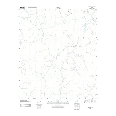
2010 Map of Goodwill
USGS Topo · Published 2010About this map
The Brazos River forms the northeastern boundary of this Milam County landscape, a region defined by a dense network of creek branches and deeply cut hollows. Small rural communities like Hix and Goodwill anchor the road system, which includes a mix of Farm-to-Market roads and local county routes. The terrain is marked by significant topographical features such as Whiskey Hollow, Coopers Hollow, and Bailey Hollow, which channel water toward major tributaries like Cedar Creek and Little Cedar Creek.
Find a feature on this map
49 named features on this map. Tap any name to fly to it.
Don’t see what you’re looking for? This feature index may not catch every label — zoom into the map to look around manually.
Map Details
Editions of this 2010 Goodwill Map
This is the sole edition of this map. No revisions or reprints were ever made.
Other maps of this area

1954 · Austin
USGS Topo · 1:250,000

1956 · Caldwell
USGS Topo · 1:62,500

1956 · Milano
USGS Topo · 1:62,500
1961 · Caldwell
USGS Topo · 1:24,000

1961 · Mumford
USGS Topo · 1:24,000

1961 · Hanover
USGS Topo · 1:24,000

1961 · Hearne South
USGS Topo · 1:24,000

1962 · Goodwill
USGS Topo · 1:24,000
1962 · Chriesman
USGS Topo · 1:24,000
1962 · Tunis
USGS Topo · 1:24,000