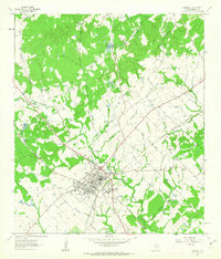
1961 Map of Caldwell
USGS Topo · Published 1963About this map
The railroad junction at Caldwell serves as the focal point for this Burleson County landscape during the early 1960s, where the Gulf Colorado and Santa Fe and Southern Pacific lines intersect. This central hub is surrounded by a dense network of family and community landmarks, particularly evident in the numerous rural churches and burial grounds like the New Tabor Brethren Ch and Elizabeth Chapel Cem. The terrain is defined by the broad Denton Valley and winding waterways such as Davidson Creek and Pecan Hollow Creek.
Find a feature on this map
39 named features on this map. Tap any name to fly to it.
Don’t see what you’re looking for? This feature index may not catch every label — zoom into the map to look around manually.
Map Details
Editions of this 1961 Caldwell Map
2 editions found
Other maps of this area

1919 · Dime Box
USGS Topo · 1:62,500

1954 · Austin
USGS Topo · 1:250,000

1956 · Caldwell
USGS Topo · 1:62,500

1956 · Milano
USGS Topo · 1:62,500

1956 · Somerville
USGS Topo · 1:62,500

1960 · Lyons
USGS Topo · 1:24,000
1960 · Frenstat
USGS Topo · 1:24,000
1960 · Deanville
USGS Topo · 1:24,000

1961 · Mumford
USGS Topo · 1:24,000

1962 · Goodwill
USGS Topo · 1:24,000