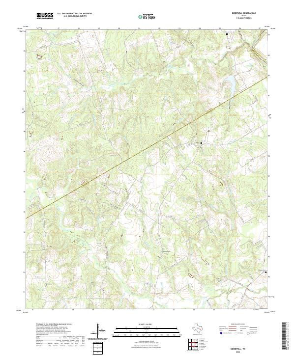
2022 Map of Goodwill
USGS Topo · Published 2022About this map
Hix serves as the primary landmark in this rural landscape at the boundary of Burleson, Milam, and Robertson counties. The terrain is defined by a dense network of drainage systems, including Sixmile Cr, Threemile Cr, and the Brazos River, which cuts through the northeastern corner. Local history and genealogy are centered around family and community markers like Hix Cem, Lawson Cem, and Goodwill Cem. The development of Cedar Creek Addition and the presence of Oil Field Rd suggest the gradual shift from traditional agriculture toward residential and industrial infrastructure. The map also records several distinctively named geographical features such as Whiskey Hollow and Coopers Hollow, offering a detailed view of the region's topographical character in the early twenty-first century.
Find a feature on this map
67 named features on this map. Tap any name to fly to it.
Don’t see what you’re looking for? This feature index may not catch every label — zoom into the map to look around manually.
Map Details
Editions of this 2022 Goodwill Map
This is the sole edition of this map. No revisions or reprints were ever made.
Other maps of this area

1954 · Austin
USGS Topo · 1:250,000

1956 · Caldwell
USGS Topo · 1:62,500

1956 · Milano
USGS Topo · 1:62,500
1961 · Caldwell
USGS Topo · 1:24,000

1961 · Mumford
USGS Topo · 1:24,000

1961 · Hanover
USGS Topo · 1:24,000

1961 · Hearne South
USGS Topo · 1:24,000

1962 · Goodwill
USGS Topo · 1:24,000
1962 · Chriesman
USGS Topo · 1:24,000
1962 · Tunis
USGS Topo · 1:24,000