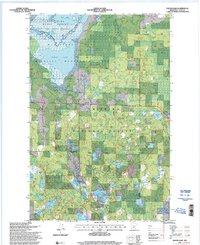
1996 Map of Goose Lake
USGS Topo · Published 2000About this map
Leech Lake Indian Reservation and the Chippewa National Forest converge in this corner of Cass County, creating a landscape defined by its intricate water systems and conservation boundaries. At the heart of the area lies the Goose Lake Wildlife Management Area, where the Leech Lake River connects Mud Goose Lake to the larger Goose Lake. This 1990s-era data reflects a region heavily managed for both timber and wildlife, evidenced by the Bowstring State Forest and the Johnson Lake Trail System.
Find a feature on this map
34 named features on this map. Tap any name to fly to it.
Don’t see what you’re looking for? This feature index may not catch every label — zoom into the map to look around manually.
Map Details
Editions of this 1996 Goose Lake Map
2 editions found
Other maps of this area

1954 · Bemidji
USGS Topo · 1:250,000

1954 · Hibbing
USGS Topo · 1:250,000

1957 · Bemidji
USGS Topo · 1:250,000

1957 · Hibbing
USGS Topo · 1:250,000

1958 · Bemidji
USGS Topo · 1:250,000

1958 · Hibbing
USGS Topo · 1:250,000

1964 · Hibbing
USGS Topo · 1:250,000
1970 · Deer River
USGS Topo · 1:24,000

1970 · Ball Club
USGS Topo · 1:24,000
1971 · Remer
USGS Topo · 1:24,000