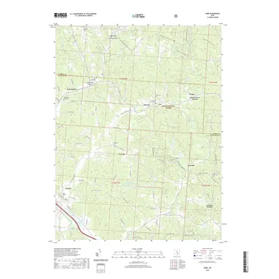
2019 Map of Gore
USGS Topo · Published 2019About this map
Wayne National Forest land defines much of this Hocking County landscape, where the confluence of steep hollows and narrow creek bottoms shaped the local road and rail networks. Small settlements and industrial junctions like Monday Creek Junction and Sand Run Junction speak to the region's history of resource extraction and transit. The map reveals a dense network of family and community history through its many burial grounds, including the Otterbein Chapel Cem, Smith Chapel Cem, and the remote Dawley Cem. Watercourses such as Monday Cr and Little Monday Cr wind through the hills, while the N Country National Scenic Trail traverses the northern ridges near Maxville. The proximity of Old Gore and Gore illustrates the shifting centers of local life over time, all set against the backdrop of the Hocking River valley in the southwest.
Find a feature on this map
88 named features on this map. Tap any name to fly to it.
Don’t see what you’re looking for? This feature index may not catch every label — zoom into the map to look around manually.
Map Details
Editions of this 2019 Gore Map
This is the sole edition of this map. No revisions or reprints were ever made.
Other maps of this area

1903 · Athens
USGS Topo · 1:62,500

1904 · Zaleski
USGS Topo · 1:62,500

1905 · Athens
USGS Topo · 1:62,500

1907 · Zaleski
USGS Topo · 1:62,500

1907 · Logan
USGS Topo · 1:62,500

1909 · Logan
USGS Topo · 1:62,500

1911 · New Lexington
USGS Topo · 1:62,500

1947 · Columbus
USGS Topo · 1:250,000

1961 · Columbus
USGS Topo · 1:250,000

1961 · Nelsonville
USGS Topo · 1:24,000