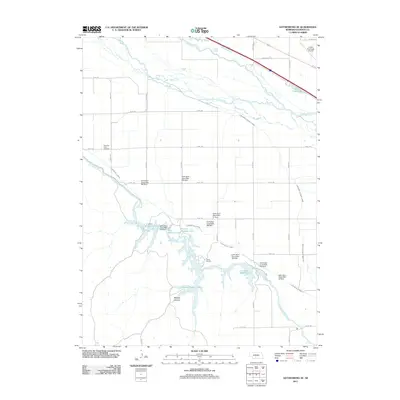
2011 Map of Gothenburg SE
USGS Topo · Published 2011About this map
The Platte River valley in central Nebraska is defined here by a sophisticated network of irrigation and water management infrastructure, most notably the Tri County Supply Canal and the Thirtymile Canal. This 2011 survey documents a landscape of engineered waterways feeding into a series of reservoirs including West Midway Lake, Central Midway Lake, and East Midway Lake. These water bodies are secured by a chain of earth dams, such as Earth Dam- Canal Mile 515 Dam, which support the regional agricultural economy.
Find a feature on this map
37 named features on this map. Tap any name to fly to it.
Don’t see what you’re looking for? This feature index may not catch every label — zoom into the map to look around manually.
Map Details
Editions of this 2011 Gothenburg SE Map
This is the sole edition of this map. No revisions or reprints were ever made.
Other maps of this area

1896 · Lexington
USGS Topo · 1:125,000

1899 · Lexington
USGS Topo · 1:125,000

1902 · Gothenburg
USGS Topo · 1:125,000

1954 · McCook
USGS Topo · 1:250,000

1955 · Grand Island
USGS Topo · 1:250,000

1957 · McCook
USGS Topo · 1:250,000

1957 · Grand Island
USGS Topo · 1:250,000

1958 · McCook
USGS Topo · 1:250,000

1958 · Grand Island
USGS Topo · 1:250,000
1970 · Gothenburg
USGS Topo · 1:24,000