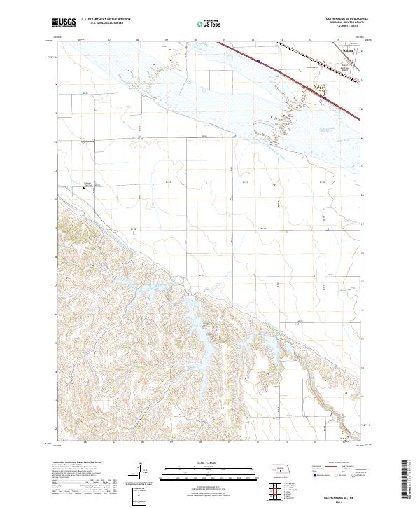
2021 Map of Gothenburg SE
USGS Topo · Published 2021About this map
The Platte River corridor dominates this section of Dawson County, where the landscape is defined by an intricate network of irrigation and transport infrastructure. The northern portion of the map shows the proximity of Cozad, anchored by the Cozad Municipal Airport and the braided waters of the North Channel Platte River. This region illustrates the critical role of water management in Nebraska's agricultural history, evidenced by the paths of the Orchard Alfalfa Canal, Thirtymile Canal, and the Tri-County Supply Canal. As the terrain moves south of the river valley, the flat plains give way to more complex topography near Midway Canyon and West Midway Lake. For those researching local heritage, the Pleasant View Cem stands as a quiet marker of the community's generational ties to this fertile river valley.
Find a feature on this map
35 named features on this map. Tap any name to fly to it.
Don’t see what you’re looking for? This feature index may not catch every label — zoom into the map to look around manually.
Map Details
Editions of this 2021 Gothenburg SE Map
This is the sole edition of this map. No revisions or reprints were ever made.
Other maps of this area

1896 · Lexington
USGS Topo · 1:125,000

1899 · Lexington
USGS Topo · 1:125,000

1902 · Gothenburg
USGS Topo · 1:125,000

1954 · McCook
USGS Topo · 1:250,000

1955 · Grand Island
USGS Topo · 1:250,000

1957 · McCook
USGS Topo · 1:250,000

1957 · Grand Island
USGS Topo · 1:250,000

1958 · McCook
USGS Topo · 1:250,000

1958 · Grand Island
USGS Topo · 1:250,000
1970 · Gothenburg
USGS Topo · 1:24,000