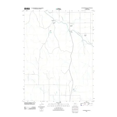
2011 Map of Gothenburg SW
USGS Topo · Published 2011About this map
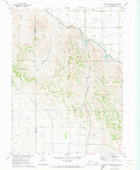
Hydraulic engineering and canyon terrain define this section of Lincoln County, where the Tri-County Supply Canal and the Thirtymile Canal carve through the plains. The landscape is characterized by a series of significant canyons, including West Smith Canyon, East Smith Canyon, and the deeply inset Wiggens Cyn. These natural drainages are integrated into a system of water management evidenced by several reservoirs and dams. Specifically, Wiggins Reservoir, held by Wiggins Dam, and Young Reservoir at Young Dam provide essential water storage in this semi-arid region. The map also traces the winding course of North Plum Creek and identifies infrastructure like the Earth Dam- Canal Mile 408 Dam, illustrating the complex intersection of natural geography and man-made irrigation efforts in early 21st-century Nebraska.
Find a feature on this map
25 named features on this map. Tap any name to fly to it.
Don’t see what you’re looking for? This feature index may not catch every label — zoom into the map to look around manually.
Map Details
Editions of this 2011 Gothenburg SW Map
This is the sole edition of this map. No revisions or reprints were ever made.
Other maps of this area

1902 · Gothenburg
USGS Topo · 1:125,000

1954 · McCook
USGS Topo · 1:250,000

1956 · Stockville NE
USGS Topo · 1:24,000

1957 · McCook
USGS Topo · 1:250,000

1958 · McCook
USGS Topo · 1:250,000
1970 · Gothenburg
USGS Topo · 1:24,000
1970 · Eustis
USGS Topo · 1:24,000
1970 · Jeffrey Reservoir SE
USGS Topo · 1:24,000
1970 · Gothenburg SW
USGS Topo · 1:24,000
1970 · Willow Island
USGS Topo · 1:24,000