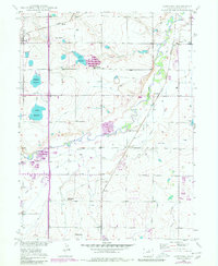
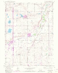
1949 Map of Gowanda
USGS Topo · Published 1980About this map
St Vrain Creek meanders through this portion of Weld County, defining a landscape of irrigation ditches and rural infrastructure as it stood in the mid-20th century. The settlement of Gowanda and the crossroads at Mead anchor the northern reaches, while the Union Pacific railroad corridor facilitates movement through Harney. This survey captures the transition of local education, noting the Pearl Howlett School (Aban'd) alongside the St Vrain Sch and Dailey School, providing a clear look at the school districts serving the farming community.
Find a feature on this map
21 named features on this map. Tap any name to fly to it.
Don’t see what you’re looking for? This feature index may not catch every label — zoom into the map to look around manually.
Map Details
Editions of this 1949 Gowanda Map
6 editions found
Other maps of this area

1902 · Greeley
USGS Topo · 1:125,000

1904 · Niwot
USGS Topo · 1:62,500

1906 · Loveland
USGS Topo · 1:62,500

1908 · Loveland
USGS Topo · 1:62,500

1949 · Gowanda
USGS Topo · 1:24,000

1949 · Fort Lupton
USGS Topo · 1:24,000

1949 · Platteville
USGS Topo · 1:24,000

1950 · Frederick
USGS Topo · 1:24,000

1950 · Gowanda
USGS Topo · 1:24,000

1950 · Platteville
USGS Topo · 1:24,000