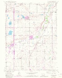
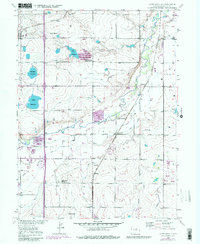
1949 Map of Gowanda
USGS Topo · Published 1983About this map
The agricultural plains of Weld County come into focus through a network of irrigation ditches and reservoirs, including Mulligan Reservoir and Foster Reservoir, which supported the region's sugar beet and livestock economy. Small rural centers like Mead and Gowanda are linked by the Great Western and Union Pacific railroads, while the rural social fabric is evidenced by local landmarks like the Rinn Valley Grange and several educational sites.
Find a feature on this map
28 named features on this map. Tap any name to fly to it.
Don’t see what you’re looking for? This feature index may not catch every label — zoom into the map to look around manually.
Map Details
Editions of this 1949 Gowanda Map
6 editions found
Other maps of this area

1902 · Greeley
USGS Topo · 1:125,000

1904 · Niwot
USGS Topo · 1:62,500

1906 · Loveland
USGS Topo · 1:62,500

1908 · Loveland
USGS Topo · 1:62,500

1949 · Gowanda
USGS Topo · 1:24,000

1949 · Fort Lupton
USGS Topo · 1:24,000

1949 · Platteville
USGS Topo · 1:24,000

1950 · Frederick
USGS Topo · 1:24,000

1950 · Gowanda
USGS Topo · 1:24,000

1950 · Platteville
USGS Topo · 1:24,000