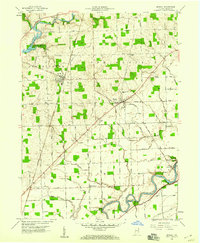
1958 Map of Grabill
USGS Topo · Published 1976About this map
The St Joseph River and Maumee River define the agricultural landscape of northeastern Indiana in the late 1950s. Centered on the town of Grabill, this survey documents a period when rural life revolved around established crossroads like Harlan and small hamlets such as Milan Center. The industrial and transport history of the region is evident in the path of the Wabash RR and the remnants of the Erie Canal near the Maumee. Infrastructure of the era is marked by the Cedarville Reservoir and its Spillway, while numerous family-named ditches like Boser Ditch and Spencerville Ditch illustrate the extensive drainage network required for the local farms. Genealogists will find several burial sites including Yaggy Cem, Memorial Cem, and Barnett Cem, alongside landmarks such as Salem Com Ch and the Zion Sch.
Find a feature on this map
72 named features on this map. Tap any name to fly to it.
Don’t see what you’re looking for? This feature index may not catch every label — zoom into the map to look around manually.
Map Details
Editions of this 1958 Grabill Map
3 editions found
Other maps of this area

1953 · Fort Wayne
USGS Topo · 1:250,000

1956 · Fort Wayne
USGS Topo · 1:250,000

1956 · Fort Wayne East
USGS Topo · 1:24,000

1956 · Cedarville
USGS Topo · 1:24,000

1957 · Auburn
USGS Topo · 1:24,000

1957 · Maples
USGS Topo · 1:24,000

1958 · Hicksville
USGS Topo · 1:24,000

1958 · Grabill
USGS Topo · 1:24,000

1958 · Woodburn North
USGS Topo · 1:24,000
1958 · Saint Joe
USGS Topo · 1:24,000