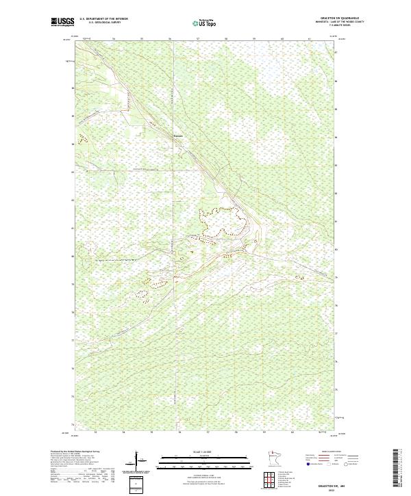
2022 Map of Graceton SW
USGS Topo · Published 2022About this map
Faunce serves as the central point for this northern Minnesota landscape, where the vast wetlands and forests of Lake of the Woods county are traversed by a specialized network of forest roads and trails. The map detail highlights the intersection of several key routes, including Faunce Forest Rd and the Santa Ana Rd. The terrain is characterized by intricate drainage patterns and significant wetlands, which are navigated by historic paths like the Warroad/Roseau Trails Trl and the Stony Corners Trl. This survey captures the region's character as a managed wilderness, where travel is dictated by the high-ground ridges and the maintenance of routes like the E Entrance Hogsback Obrien Trl and Spina Forest Trl. It reflects the modern state of land management and access in one of the state's most sparsely populated forest regions.
Find a feature on this map
15 named features on this map. Tap any name to fly to it.
Don’t see what you’re looking for? This feature index may not catch every label — zoom into the map to look around manually.
Map Details
Editions of this 2022 Graceton SW Map
This is the sole edition of this map. No revisions or reprints were ever made.
Other maps of this area

1918 · Winterroad
USGS Topo · 1:62,500

1918 · F
USGS Topo · 1:62,500

1919 · Peppermint Creek
USGS Topo · 1:62,500

1919 · G
USGS Topo · 1:62,500

1943 · Peppermint Creek
USGS Topo · 1:62,500

1954 · Roseau
USGS Topo · 1:250,000

1957 · Roseau
USGS Topo · 1:250,000

1958 · Roseau
USGS Topo · 1:250,000
1968 · Graceton SE
USGS Topo · 1:24,000
1968 · Graceton NW
USGS Topo · 1:24,000