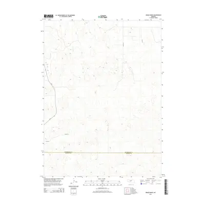
2014 Map of Gragg Ranch
USGS Topo · Published 2014About this map
Gragg Ranch serves as the primary focal point of this rural Nebraska landscape, situated near the boundary where the McPherson County and Lincoln County line divides the sandhills terrain. The area is defined by a sparse network of roads that suggest the isolation of large-scale ranching operations in the early 21st century. State highway Ne-97 winds through the western portion of the sheet, providing the main artery for transit, while smaller routes like Ringold Rd, Tupper Dr, and Gragg Dr provide access to the interior. This survey illustrates the characteristic land use of the region, where the vast, unpopulated spaces are occasionally punctuated by family-named ranch sites and the essential infrastructure required to navigate the open prairie.
Find a feature on this map
6 named features on this map. Tap any name to fly to it.
Don’t see what you’re looking for? This feature index may not catch every label — zoom into the map to look around manually.
Map Details
Editions of this 2014 Gragg Ranch Map
This is the sole edition of this map. No revisions or reprints were ever made.
Other maps of this area

1899 · North Platte
USGS Topo · 1:125,000

1902 · North Platte
USGS Topo · 1:125,000

1949 · Cody Lake
USGS Topo · 1:62,500

1951 · Tryon
USGS Topo · 1:62,500

1951 · Cody Lake
USGS Topo · 1:62,500

1954 · North Platte
USGS Topo · 1:250,000

1956 · North Platte
USGS Topo · 1:250,000

1957 · North Platte
USGS Topo · 1:250,000

1967 · North Platte
USGS Topo · 1:250,000
1972 · North Platte 2 SW
USGS Topo · 1:24,000