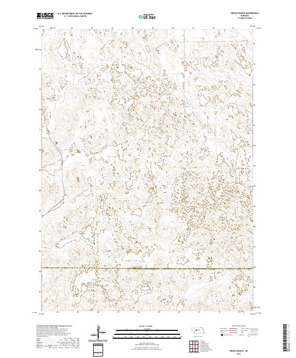
2021 Map of Gragg Ranch
USGS Topo · Published 2021About this map
Gragg Ranch serves as a primary landmark in this sparsely settled region of the Sandhills, situated near the southern border of McPherson County. The landscape is defined by the complex topography typical of this part of Nebraska, where the boundary with Lincoln County runs east-to-west across the lower portion of the map. Surface travel is facilitated by a network of rural roads such as Ringgold Rd and Gragg Dr, which navigate the undulating terrain and connect isolated ranching sites. The map's Public Land Survey System data reveals the grid of T17N and T18N, providing a clear view of the cadastral organization that underpins the region's agricultural and grazing land use. This 2021 survey offers an accurate look at contemporary land boundaries and rural infrastructure in a highly specialized ranching environment.
Find a feature on this map
13 named features on this map. Tap any name to fly to it.
Don’t see what you’re looking for? This feature index may not catch every label — zoom into the map to look around manually.
Map Details
Editions of this 2021 Gragg Ranch Map
This is the sole edition of this map. No revisions or reprints were ever made.
Other maps of this area

1899 · North Platte
USGS Topo · 1:125,000

1902 · North Platte
USGS Topo · 1:125,000

1949 · Cody Lake
USGS Topo · 1:62,500

1951 · Tryon
USGS Topo · 1:62,500

1951 · Cody Lake
USGS Topo · 1:62,500

1954 · North Platte
USGS Topo · 1:250,000

1956 · North Platte
USGS Topo · 1:250,000

1957 · North Platte
USGS Topo · 1:250,000

1967 · North Platte
USGS Topo · 1:250,000
1972 · North Platte 2 SW
USGS Topo · 1:24,000