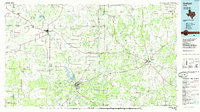
1985 Map of Graham
USGS Topo · Published 1985About this map
Graham and the Belknap Mountains anchor this North Texas landscape, where the Brazos River meets significant water management projects. This mid-1980s data highlights the region's hydrography, including Lake Graham, Lake Eddleman, and the northern reaches of Possum Kingdom Lake. The transition from the ranching lands of Young Co to the rolling hills of Jack Co is marked by a network of established settlements like Olney, Newcastle, and Jacksboro.
Find a feature on this map
133 named features on this map. Tap any name to fly to it.
Don’t see what you’re looking for? This feature index may not catch every label — zoom into the map to look around manually.
Map Details
Editions of this 1985 Graham Map
2 editions found
Other maps of this area

1890 · Breckenridge
USGS Topo · 1:125,000

1891 · Weatherford
USGS Topo · 1:125,000

1891 · Palo Pinto
USGS Topo · 1:125,000

1892 · Albany
USGS Topo · 1:125,000

1893 · Albany
USGS Topo · 1:125,000

1893 · Weatherford
USGS Topo · 1:125,000

1905 · Montague
USGS Topo · 1:125,000

1918 · Palo Pinto
USGS Topo · 1:125,000

1924 · Breckenridge 1-a
USGS Topo · 1:48,000

1924 · Palo Pinto 2-b
USGS Topo · 1:48,000