
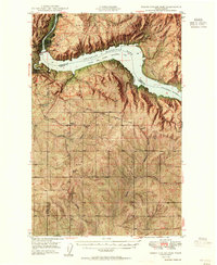
1950 Map of Grand Coulee Dam
USGS Topo · Published 1950About this map
Franklin D Roosevelt Lake National Recreational Area dominates this mid-century landscape, created by the massive engineering of the Grand Coulee Dam. The map captures the infrastructure of the post-war era, from the Pumping Plant near the dam to the Grand Coulee Grange serving the agricultural communities to the south. The terrain is deeply carved by water and time, featuring dramatic local landmarks like Jack Woods Butte and the winding Swawilla Basin.
Find a feature on this map
41 named features on this map. Tap any name to fly to it.
Don’t see what you’re looking for? This feature index may not catch every label — zoom into the map to look around manually.
Map Details
Editions of this 1950 Grand Coulee Dam Map
2 editions found
Other maps of this area

1948 · Grand Coulee Dam
USGS Topo · 1:62,500

1948 · Wilbur
USGS Topo · 1:62,500

1950 · Wilbur
USGS Topo · 1:62,500

1950 · Nespelem
USGS Topo · 1:62,500

1950 · Alameda Flat
USGS Topo · 1:62,500

1952 · Alameda Flat
USGS Topo · 1:62,500

1952 · Keller
USGS Topo · 1:62,500

1953 · Ritzville
USGS Topo · 1:250,000

1954 · Okanogan
USGS Topo · 1:250,000

1958 · Okanogan
USGS Topo · 1:250,000