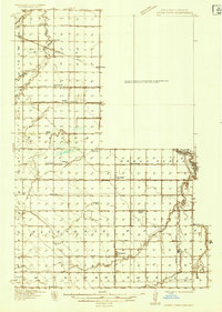
1934 Map of Grand Forks
USGS Topo · Published 1934About this map
Great Northern Pacific and Great Northern rail lines dominate the landscape of the Red River Valley in this mid-1930s survey. The area exhibits a dense network of local civic infrastructure, including numerous rural schools like School No 25 and School No 107 that served the farming townships of Brenna and Union. The map highlights a transition between the alkaline waters of Kelly Slough and the drainage of Fresh Water Coulee, marking a distinct hydrological divide in the prairie terrain. Smaller commercial and social hubs are captured in their prime, such as Walle Store and the Rye Town Hall, which provided central meeting points for the surrounding agricultural community before the consolidation of these smaller settlements into the larger regional centers.
Find a feature on this map
41 named features on this map. Tap any name to fly to it.
Don’t see what you’re looking for? This feature index may not catch every label — zoom into the map to look around manually.
Map Details
Editions of this 1934 Grand Forks Map
2 editions found
Other maps of this area

1918 · Warren
USGS Topo · 1:62,500

1919 · Eldred
USGS Topo · 1:62,500

1926 · Ardoch
USGS Topo · 1:62,500

1934 · Emerado
USGS Topo · 1:48,000

1934 · Grand Forks
USGS Topo · 1:24,000

1934 · Grand Forks
USGS Topo · 1:62,500

1936 · Emerado
USGS Topo · 1:62,500

1938 · Grand Forks
USGS Topo · 1:62,500

1952 · Grand Forks
USGS Topo · 1:250,000

1952 · Thief River Falls
USGS Topo · 1:250,000