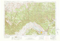
1956 Map of Grand Junction
USGS Topo · Published 1978About this map
The Colorado River corridor defines the southern axis of this 1956 survey, where the concentrated agriculture of Grand Junction, Fruita, and Palisade meets the dramatic rising terrain of the Book Cliffs and Grand Mesa. Following the path of the Denver & Rio Grande Western RR, the map reveals a network of small rail settlements and sidings like Agate Siding, Floy, and Cisco that once supported transportation across the high desert.
Find a feature on this map
158 named features on this map. Tap any name to fly to it.
Don’t see what you’re looking for? This feature index may not catch every label — zoom into the map to look around manually.
Map Details
Editions of this 1956 Grand Junction Map
2 editions found

Other maps of this area

1885 · San Rafael
USGS Topo · 1:250,000

1885 · East Tavaputs
USGS Topo · 1:250,000

1885 · La Sal
USGS Topo · 1:250,000

1885 · Ashley
USGS Topo · 1:250,000

1885 · Uinta
USGS Topo · 1:250,000

1886 · Price River
USGS Topo · 1:250,000

1896 · Price River
USGS Topo · 1:250,000

1906 · Grand Hogback
USGS Topo · 1:125,000

1907 · Rangely
USGS Topo · 1:125,000

1907 · Jensen
USGS Topo · 1:125,000