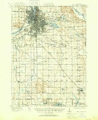
1962 Map of Grand Rapids
USGS Topo · Published 1962This historical map portrays the area of Grand Rapids in 1962, primarily covering Kent County as well as portions of Hillsdale County, Branch County, Washtenaw County, Ottawa County, Ingham County, Kalamazoo, Livingston County, Jackson County, Calhoun County, Allegan County, Eaton County, Lenawee County, Clinton County, Van Buren County, Shiawassee County, Ionia County, Barry County, St. Joseph County, and Cass County. Featuring a scale of 1:250000, this map provides a highly detailed snapshot of the terrain, roads, buildings, counties, and historical landmarks in the Grand Rapids region at the time. Published in 1962, it is one of 2 known editions of this map due to revisions or reprints.
Find a feature on this map
267 named features on this map. Tap any name to fly to it.
Don’t see what you’re looking for? This feature index may not catch every label — zoom into the map to look around manually.
Map Details
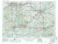
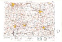
Editions of this 1962 Grand Rapids Map
2 editions found
Historical Maps of Ovid Through Time
6 maps found