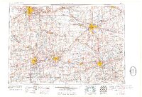
1962 Map of Grand Rapids
USGS Topo · Published 1962About this map
Grand Rapids and Lansing anchor this detailed mid-century survey of South Central Michigan, documenting a landscape where industrial centers and agriculture meet an extensive network of state-managed lands. The map illustrates the region's complex water system, following the Grand River and Kalamazoo River through several counties. Between the urban hubs of Battle Creek and Kalamazoo, the Fort Custer Military Reservation stands as a significant landmark of the era's defense infrastructure.
Find a feature on this map
320 named features on this map. Tap any name to fly to it.
Don’t see what you’re looking for? This feature index may not catch every label — zoom into the map to look around manually.
Map Details
Editions of this 1962 Grand Rapids Map
2 editions found

Other maps of this area

1902 · Dexter
USGS Topo · 1:62,500

1904 · Ann Arbor
USGS Topo · 1:125,000

1906 · Dexter
USGS Topo · 1:62,500

1906 · Saline
USGS Topo · 1:62,500

1907 · Howell
USGS Topo · 1:62,500

1908 · Ann Arbor
USGS Topo · 1:125,000

1908 · Fowlerville
USGS Topo · 1:62,500

1909 · Howell
USGS Topo · 1:62,500

1909 · Mason
USGS Topo · 1:62,500

1910 · Fowlerville
USGS Topo · 1:62,500