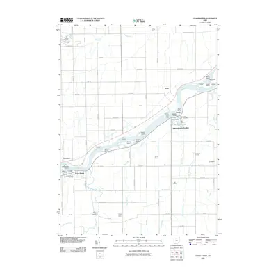
2010 Map of Grand Rapids
USGS Topo · Published 2010About this map
The Maumee River defines the geography of this 2010 survey, cutting a wide path through Lucas County as it flows past a sequence of riverine islands including Missionary Island, Otter Island, and Fox Island. The settlement of Grand Rapids sits on the southern bank, while the small community of Providence occupies the northern shore. Downstream, the development at Williamsburg-On-The-River surrounds Williamsburg Lake, which is contained by both an East Dam and a West Dam.
Find a feature on this map
83 named features on this map. Tap any name to fly to it.
Don’t see what you’re looking for? This feature index may not catch every label — zoom into the map to look around manually.
Map Details
Editions of this 2010 Grand Rapids Map
This is the sole edition of this map. No revisions or reprints were ever made.
Other maps of this area

1900 · Toledo
USGS Topo · 1:62,500

1901 · Bowling Green
USGS Topo · 1:62,500

1903 · Bowling Green
USGS Topo · 1:62,500

1909 · Mc Clure
USGS Topo · 1:62,500

1911 · Swanton
USGS Topo · 1:62,500

1914 · Swanton
USGS Topo · 1:62,500

1935 · Grand Rapids
USGS Topo · 1:24,000

1935 · Whitehouse
USGS Topo · 1:24,000

1935 · Maumee
USGS Topo · 1:24,000
1938 · Maumee
USGS Topo · 1:31,680