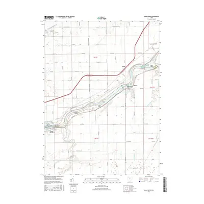
2016 Map of Grand Rapids
USGS Topo · Published 2016About this map
The Maumee River serves as the central artery and county boundary on this 2016 survey, carving a path between Lucas Co and Wood Co. The river landscape is notably dense with islands, including Number 3 Island, Sheets Island, and Indian Island, while the Towpath Trail traces the northern bank, reflecting the corridor's long-standing transportation significance. To the north, the settlement of Neapolis is positioned near the N Country National Scenic Trail and the headwaters of Blue Cr.
Find a feature on this map
63 named features on this map. Tap any name to fly to it.
Don’t see what you’re looking for? This feature index may not catch every label — zoom into the map to look around manually.
Map Details
Editions of this 2016 Grand Rapids Map
This is the sole edition of this map. No revisions or reprints were ever made.
Other maps of this area

1900 · Toledo
USGS Topo · 1:62,500

1901 · Bowling Green
USGS Topo · 1:62,500

1903 · Bowling Green
USGS Topo · 1:62,500

1909 · Mc Clure
USGS Topo · 1:62,500

1911 · Swanton
USGS Topo · 1:62,500

1914 · Swanton
USGS Topo · 1:62,500

1935 · Grand Rapids
USGS Topo · 1:24,000

1935 · Whitehouse
USGS Topo · 1:24,000

1935 · Maumee
USGS Topo · 1:24,000
1938 · Maumee
USGS Topo · 1:31,680