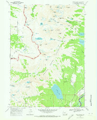
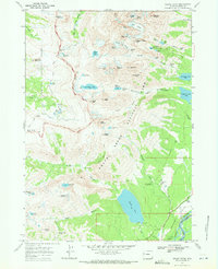
1968 Map of Grand Teton
USGS Topo · Published 1973About this map
Grand Teton National Park dominates this 1968 landscape, characterized by the dramatic verticality of the Teton Range. The survey highlights several historic properties and working ranches within the park boundaries and nearby Jackson Hole, including the White Grass Ranch, J Y Ranch, and R Lazy S Ranch. These sites represent the era's blend of conservation and traditional land use. Higher elevations are defined by named geological features like the Hurricane Pass, the massive The Wall, and active ice fields such as Schoolroom Glacier and Teton Glacier. The transition from the high peaks like Grand Teton down through Death Canyon to the shores of Phelps Lake illustrates the complex drainage systems of the region, where water moves from alpine basins into the Snake River valley.
Find a feature on this map
77 named features on this map. Tap any name to fly to it.
Don’t see what you’re looking for? This feature index may not catch every label — zoom into the map to look around manually.
Map Details
Editions of this 1968 Grand Teton Map
3 editions found
Other maps of this area

1899 · Grand Teton
USGS Topo · 1:125,000

1901 · Grand Teton
USGS Topo · 1:125,000

1955 · Driggs
USGS Topo · 1:250,000

1958 · Driggs
USGS Topo · 1:250,000

1962 · Driggs
USGS Topo · 1:250,000
1968 · Granite Basin
USGS Topo · 1:24,000
1968 · Teton Village
USGS Topo · 1:24,000

1968 · Moose
USGS Topo · 1:24,000
1968 · Grand Teton
USGS Topo · 1:24,000
1968 · Jenny Lake
USGS Topo · 1:24,000