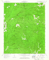
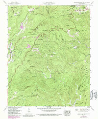
1960 Map of Grandfather Mountain
USGS Topo · Published 1966About this map
Calloway Peak stands as the dramatic high point of this high-elevation landscape, where the Blue Ridge Parkway winds along the crest of the Blue Ridge. The map documents a rugged transition from the resort settlement of Linville and its surrounding Pisgah National Forest land to the deep drainages of the Daniel Boone Wildlife Management Area. A notable concentration of human engineering is found near Grandmother Gap, including the U.S. Weather Station Mile High Swinging Bridge.
Find a feature on this map
79 named features on this map. Tap any name to fly to it.
Don’t see what you’re looking for? This feature index may not catch every label — zoom into the map to look around manually.
Map Details
Editions of this 1960 Grandfather Mountain Map
5 editions found
Other maps of this area

1893 · Cranberry
USGS Topo · 1:125,000

1895 · Cranberry
USGS Topo · 1:125,000

1899 · Cranberry
USGS Topo · 1:125,000

1902 · Cranberry
USGS Topo · 1:125,000

1905 · Morganton
USGS Topo · 1:125,000

1934 · Valle Crucis
USGS Topo · 1:24,000

1934 · Elk Park
USGS Topo · 1:24,000

1934 · Linville Falls
USGS Topo · 1:24,000

1934 · Boone
USGS Topo · 1:24,000

1934 · Newland
USGS Topo · 1:24,000