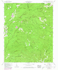
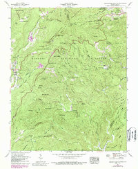
1960 Map of Grandfather Mountain
USGS Topo · Published 1978About this map
Linville serves as a primary settlement on this landscape, which is defined by the high elevations of the Tennessee Valley Divide and the Pisgah National Forest. The map documents the mountain economy and infrastructure of the mid-20th century, including the U.S. Weather Station Mile High Swinging Bridge and a quarry near Linville Bluffs. Transport and recreation are integrated into the terrain via the Blue Ridge Parkway and the Daniel Boone Scout Trail, which winds past Raven Rocks. Small rural communities like Gragg and Edgemont are preserved here, supported by local institutions such as New Hopewell Church and Peoples Ch. The geography is deeply etched by water, with Wilson Creek and the Linville River draining the ridges, while various family-named landmarks like Coffey Trout Lake and the Gragg Cem provide specific points of interest for genealogical research.
Find a feature on this map
104 named features on this map. Tap any name to fly to it.
Don’t see what you’re looking for? This feature index may not catch every label — zoom into the map to look around manually.
Map Details
Editions of this 1960 Grandfather Mountain Map
5 editions found
Other maps of this area

1893 · Cranberry
USGS Topo · 1:125,000

1895 · Cranberry
USGS Topo · 1:125,000

1899 · Cranberry
USGS Topo · 1:125,000

1902 · Cranberry
USGS Topo · 1:125,000

1905 · Morganton
USGS Topo · 1:125,000

1934 · Valle Crucis
USGS Topo · 1:24,000

1934 · Elk Park
USGS Topo · 1:24,000

1934 · Linville Falls
USGS Topo · 1:24,000

1934 · Boone
USGS Topo · 1:24,000

1934 · Newland
USGS Topo · 1:24,000