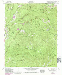
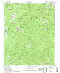
1960 Map of Grandfather Mountain
USGS Topo · Published 1988About this map
The Tennessee Valley Divide snakes across the high ridges of this landscape, separating the headwaters of the Watauga River from the south-flowing Linville River and Wilson Creek. This map, based on a 1960 field check with 1978 updates, showcases the developing recreation and conservation corridor centered around the Blue Ridge Parkway. Landmarks like the U.S. Weather Station and Julian Price Memorial Park are established alongside the deep-seated timber and small-scale farming history of the region.
Find a feature on this map
91 named features on this map. Tap any name to fly to it.
Don’t see what you’re looking for? This feature index may not catch every label — zoom into the map to look around manually.
Map Details
Editions of this 1960 Grandfather Mountain Map
5 editions found
Other maps of this area

1893 · Cranberry
USGS Topo · 1:125,000

1895 · Cranberry
USGS Topo · 1:125,000

1899 · Cranberry
USGS Topo · 1:125,000

1902 · Cranberry
USGS Topo · 1:125,000

1905 · Morganton
USGS Topo · 1:125,000

1934 · Valle Crucis
USGS Topo · 1:24,000

1934 · Elk Park
USGS Topo · 1:24,000

1934 · Linville Falls
USGS Topo · 1:24,000

1934 · Boone
USGS Topo · 1:24,000

1934 · Newland
USGS Topo · 1:24,000