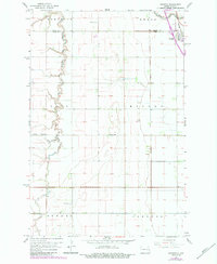
1967 Map of Grandin
USGS Topo · Published 1984About this map
Grandin serves as the primary hub for this fertile Red River Valley landscape, situated along the Burlington Northern railroad near the border of Traill and Cass Counties. The terrain is defined by the winding course of the Elm River and its South Branch, which carve intricate meanders across the flat agricultural sections of Bohnsack, Kelso, and Bell.
Find a feature on this map
16 named features on this map. Tap any name to fly to it.
Don’t see what you’re looking for? This feature index may not catch every label — zoom into the map to look around manually.
Map Details
Editions of this 1967 Grandin Map
2 editions found
Other maps of this area

1918 · Kelso
USGS Topo · 1:62,500

1918 · Hendrum
USGS Topo · 1:62,500

1943 · Kelso
USGS Topo · 1:62,500

1952 · Grand Forks
USGS Topo · 1:250,000

1956 · Grand Forks
USGS Topo · 1:250,000
1963 · Argusville
USGS Topo · 1:24,000

1963 · Gardner
USGS Topo · 1:24,000

1963 · Kelso
USGS Topo · 1:24,000

1963 · Halstad SW
USGS Topo · 1:24,000

1966 · Grand Forks
USGS Topo · 1:250,000