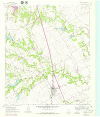
1961 Map of Grandview
USGS Topo · Published 1978About this map
The Missouri Kansas Texas railroad line bisects this portion of North Texas, anchoring the community of Grandview. This 1960s survey, with late 1970s updates, documents a landscape shaped by the numerous branches of the Chambers Creek system, including the North Fork, Middle Fork, and South Fork. The map serves as a detailed record for genealogists, identifying family-linked sites such as Boatright Cem and Old Hill Cem, alongside rural focal points like Antioch and the Barnesville Ch. Near the northern edge, Lake Alvarado marks the local drainage into Turkey Creek, while the southern reaches cross the Johnson Co Hill Co line. The settlement pattern reflects the late 20th-century transition of this agricultural region, where established churches and cemeteries remained the primary landmarks between expanding transport corridors.
Find a feature on this map
24 named features on this map. Tap any name to fly to it.
Don’t see what you’re looking for? This feature index may not catch every label — zoom into the map to look around manually.
Map Details
Editions of this 1961 Grandview Map
2 editions found
Other maps of this area

1891 · Cleburne
USGS Topo · 1:125,000

1894 · Cleburne
USGS Topo · 1:125,000

1927 · Blum
USGS Topo · 1:62,500

1954 · Dallas
USGS Topo · 1:250,000

1958 · Dallas
USGS Topo · 1:250,000

1960 · Keene
USGS Topo · 1:24,000

1960 · Cleburne East
USGS Topo · 1:24,000
1961 · Maypearl
USGS Topo · 1:24,000

1961 · Alvarado
USGS Topo · 1:24,000
1961 · Venus
USGS Topo · 1:24,000