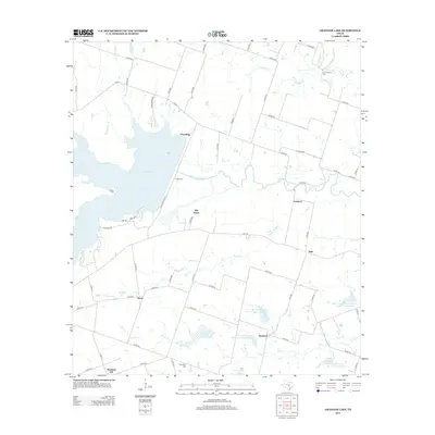
2013 Map of Granger Lake
USGS Topo · Published 2013About this map
Granger Lake dominates the northwest quadrant of this Texas landscape, a major reservoir that submerged previous terrain but preserved certain landmarks along its shoreline. Small agrarian settlements and family crossroads like Hare, Sandoval, and Friendship dot the surrounding countryside, connected by a network of county roads. For genealogists and local historians, several burial sites remain identifiable in the area, including Allison Cem near the lake and C A Hamblen Cem to the northeast. The San Gabriel River feeds the lake, while numerous tributaries like Pecan Cr and Alligator Cr drain the eastern plains. Evidence of managed water resources is clear through multiple reservoirs such as Soil Conservation Service Site 7 Reservoir, reflecting the agricultural priority of this portion of Williamson County.
Find a feature on this map
64 named features on this map. Tap any name to fly to it.
Don’t see what you’re looking for? This feature index may not catch every label — zoom into the map to look around manually.
Map Details
Editions of this 2013 Granger Lake Map
This is the sole edition of this map. No revisions or reprints were ever made.
Other maps of this area

1885 · Taylor
USGS Topo · 1:125,000

1887 · Taylor
USGS Topo · 1:125,000

1894 · Taylor
USGS Topo · 1:125,000

1910 · Buckholts
USGS Topo · 1:24,000

1912 · Buckholts
USGS Topo · 1:31,680

1954 · Austin
USGS Topo · 1:250,000
1963 · Sharp
USGS Topo · 1:24,000

1963 · Friendship
USGS Topo · 1:24,000
1963 · San Gabriel
USGS Topo · 1:24,000
1963 · Davilla
USGS Topo · 1:24,000