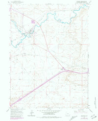
1961 Map of Granger
USGS Topo · Published 1981About this map
Blacks Fork and Hams Fork converge near the settlement of Granger, a vital crossroads in the high desert of southwest Wyoming. The landscape is a corridor of historical movement, tracing the overlap of the Emigrant Trail and the Overland Trail as they navigate the river bends. A Stage Sta Historical Marker located near the town center notes the area's significance as a transit hub, further emphasized by the presence of the Union Pacific railroad and a small Landing Strip to the south.
Find a feature on this map
23 named features on this map. Tap any name to fly to it.
Don’t see what you’re looking for? This feature index may not catch every label — zoom into the map to look around manually.
Map Details
Editions of this 1961 Granger Map
2 editions found
Other maps of this area

1954 · Ogden
USGS Topo · 1:250,000

1954 · Rock Springs
USGS Topo · 1:250,000

1958 · Ogden
USGS Topo · 1:250,000

1958 · Rock Springs
USGS Topo · 1:250,000

1960 · Ogden
USGS Topo · 1:250,000

1961 · Blue Point
USGS Topo · 1:24,000

1961 · Little America
USGS Topo · 1:24,000

1961 · Sevenmile Gulch
USGS Topo · 1:24,000

1961 · Granger
USGS Topo · 1:24,000

1962 · Rock Springs
USGS Topo · 1:250,000