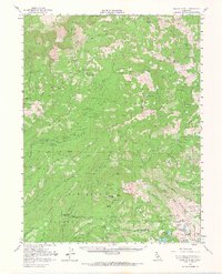
1953 Map of Granite Chief
USGS Topo · Published 1968About this map
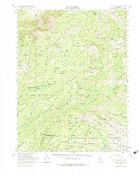
Royal Gorge and the upper reaches of the North Fork American River define this high-altitude landscape within the Tahoe National Forest. The map documents a rugged interior of the Sierra Nevada where mining history and seasonal grazing culture left a distinct footprint. Numerous small-scale operations like the Trinidad Mine, Walker Mine, and Sailor Canyon Mine are shown tucked into deep canyons, while family-named camps such as Lawyer Cow Camp and Dobbins Cow Camp indicate the era's pastoral land use. High ridgelines are marked by historical commemorative points, including the Watson Monument Emigrant Pass Marker and the Johnson Monument. The terrain is characterized by massive elevation changes, from the depths of Hell Hole to the heights of Snow Mountain and McKinstry Peak. This survey captures the transition of the region from a working mining and grazing landscape toward one of forest management and early recreation at Wentworth Springs Campground.
Find a feature on this map
140 named features on this map. Tap any name to fly to it.
Don’t see what you’re looking for? This feature index may not catch every label — zoom into the map to look around manually.
Map Details
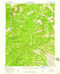
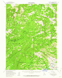
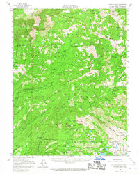
Editions of this 1953 Granite Chief Map
5 editions found
Other maps of this area

1889 · Pyramid Peak
USGS Topo · 1:125,000

1891 · Colfax
USGS Topo · 1:125,000

1891 · Truckee
USGS Topo · 1:125,000

1891 · Placerville
USGS Topo · 1:125,000

1891 · Pyramid Peak
USGS Topo · 1:125,000

1892 · Placerville
USGS Topo · 1:125,000

1892 · Colfax
USGS Topo · 1:125,000

1893 · Placerville
USGS Topo · 1:125,000

1893 · Truckee
USGS Topo · 1:125,000

1894 · Colfax
USGS Topo · 1:125,000