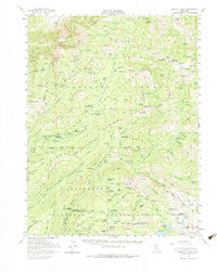
1953 Map of Granite Chief
USGS Topo · Published 1974About this map
The North Fork American River carves a dramatic path through the center of this high Sierra Nevada landscape, notably through the steep Royal Gorge. This mid-century survey captures a transitional wilderness era where old mining claims and seasonal livestock camps represent the primary human footprint. Historic prospecting is evidenced by the Trinidad Mine, Walker Mine, and the aptly named Lost Emigrant Mine near the ridge.
Find a feature on this map
186 named features on this map. Tap any name to fly to it.
Don’t see what you’re looking for? This feature index may not catch every label — zoom into the map to look around manually.
Map Details
Editions of this 1953 Granite Chief Map
5 editions found

Other maps of this area

1889 · Pyramid Peak
USGS Topo · 1:125,000

1891 · Colfax
USGS Topo · 1:125,000

1891 · Truckee
USGS Topo · 1:125,000

1891 · Placerville
USGS Topo · 1:125,000

1891 · Pyramid Peak
USGS Topo · 1:125,000

1892 · Placerville
USGS Topo · 1:125,000

1892 · Colfax
USGS Topo · 1:125,000

1893 · Placerville
USGS Topo · 1:125,000

1893 · Truckee
USGS Topo · 1:125,000

1894 · Colfax
USGS Topo · 1:125,000