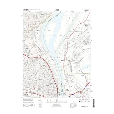
2015 Map of Granite City
USGS Topo · Published 2015About this map
The Mississippi River acts as a massive industrial and geographic divide in this 2015 survey, separating the dense urban fabric of St. Louis from the bottomlands and heavy industry of Granite City and East St. Louis. The map highlights the complex river-crossing infrastructure that defines the region, including the Merchants Bridge, McKinley Bridge, Eads Bridge, and the Martin Luther King-Junior Memorial Bridge. On the Missouri side, the sprawling grounds of Calvary Cem and Bellefontaine Cem stand in contrast to the compact street grids of neighborhoods like Baden, Hyde Park, and Carr Square. The Illinois side is dominated by the Chain of Rocks Canal and large islands like Mosenthein Island and Gabaret Island. This modern record captures the enduring intersection of academic life at Saint Louis University-Main Campus and the commercial roots of the city at Laclede's Landing.
Find a feature on this map
87 named features on this map. Tap any name to fly to it.
Don’t see what you’re looking for? This feature index may not catch every label — zoom into the map to look around manually.
Map Details
Editions of this 2015 Granite City Map
This is the sole edition of this map. No revisions or reprints were ever made.
Other maps of this area

1888 · St. Louis
USGS Topo · 1:62,500

1927 · Alton
USGS Topo · 1:62,500

1927 · St. Charles
USGS Topo · 1:62,500

1931 · French Village
USGS Topo · 1:24,000

1933 · Granite City
USGS Topo · 1:24,000

1933 · Jefferson Barracks
USGS Topo · 1:24,000

1933 · Cahokia
USGS Topo · 1:24,000

1933 · Clayton
USGS Topo · 1:24,000

1933 · Saint Charles
USGS Topo · 1:62,500

1934 · Cahokia
USGS Topo · 1:24,000