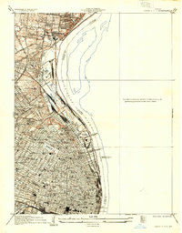
1933 Map of Granite City
USGS Topo · Published 1933About this map
The industrial and urban density of the riverfront dominates this 1933 survey, where the Mississippi River serves as the literal and economic divide between Missouri and Illinois. The Missouri side is a complex grid of residential blocks, institutional landmarks, and heavy transit infrastructure. Major connectivity is provided by the Merchants Bridge, McKinley Bridge, and the legendary Eads Bridge, which link the city's commercial core to the eastern banks. This era of urban development is marked by a massive concentration of educational and religious institutions, including St Louis University, Sumner High Sch, and the David Ranken Jr Trades Sch.
Find a feature on this map
61 named features on this map. Tap any name to fly to it.
Don’t see what you’re looking for? This feature index may not catch every label — zoom into the map to look around manually.
Map Details
Editions of this 1933 Granite City Map
2 editions found
Other maps of this area

1888 · St. Louis
USGS Topo · 1:62,500

1927 · Alton
USGS Topo · 1:62,500

1927 · St. Charles
USGS Topo · 1:62,500

1931 · French Village
USGS Topo · 1:24,000

1933 · Granite City
USGS Topo · 1:24,000

1933 · Jefferson Barracks
USGS Topo · 1:24,000

1933 · Cahokia
USGS Topo · 1:24,000

1933 · Clayton
USGS Topo · 1:24,000

1933 · Saint Charles
USGS Topo · 1:62,500

1934 · Cahokia
USGS Topo · 1:24,000