
1935 Map of Granite City
USGS Topo · Published 1935About this map
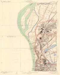
Industrial expansion and complex rail networks define this riverfront landscape during the mid-1930s. The massive street grid of Granite City dominates the east bank, supported by an intricate web of tracks including the Illinois Terminal RR and the Southern Railway. Along the Mississippi, the map documents the shifting hydrology of Mosenthein Island and Gabaret Island, while the massive National Stock Yards anchor the southern industrial corridor near Brooklyn. This era shows a densely developed riverfront before modern highway bypasses, where the Merchants Bridge and MC Kinley Bridge served as critical conduits for commerce between Illinois and Missouri. For genealogists and local historians, the sheet identifies specific community focal points like Wilson Park, Cabaret Sch, and Braden Sch, alongside established neighborhoods in Madison and Venice.
Find a feature on this map
42 named features on this map. Tap any name to fly to it.
Don’t see what you’re looking for? This feature index may not catch every label — zoom into the map to look around manually.
Map Details
Editions of this 1935 Granite City Map
2 editions found
Other maps of this area

1888 · St. Louis
USGS Topo · 1:62,500

1927 · Alton
USGS Topo · 1:62,500

1927 · St. Charles
USGS Topo · 1:62,500

1931 · French Village
USGS Topo · 1:24,000

1933 · Granite City
USGS Topo · 1:24,000

1933 · Jefferson Barracks
USGS Topo · 1:24,000

1933 · Cahokia
USGS Topo · 1:24,000

1933 · Clayton
USGS Topo · 1:24,000

1933 · Saint Charles
USGS Topo · 1:62,500

1934 · Cahokia
USGS Topo · 1:24,000