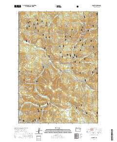
2020 Map of Granite
USGS Topo · Published 2020About this map
Granite sits as a primary settlement within a high-elevation landscape defined by the intersection of the Umatilla National Forest and Whitman National Forest. The 2020 terrain is deeply incised by drainages such as Granite Cr and Bull Run Cr, creating a complex network of ridges and gulches that dictated the historic routes of travel. Local landforms like Quebec Hill and Ten Cent Butte stand as prominent landmarks overlooking the forest canopy.
Find a feature on this map
53 named features on this map. Tap any name to fly to it.
Don’t see what you’re looking for? This feature index may not catch every label — zoom into the map to look around manually.
Map Details
Editions of this 2020 Granite Map
This is the sole edition of this map. No revisions or reprints were ever made.
Other maps of this area

1901 · Sumpter
USGS Topo · 1:125,000

1951 · Bates
USGS Topo · 1:62,500

1951 · Desolation Butte
USGS Topo · 1:62,500

1955 · Canyon City
USGS Topo · 1:250,000

1959 · Canyon City
USGS Topo · 1:250,000

1961 · Whitney
USGS Topo · 1:24,000

1972 · Trout Meadows
USGS Topo · 1:24,000

1972 · Mt. Ireland
USGS Topo · 1:24,000
1972 · Granite
USGS Topo · 1:24,000

1972 · Greenhorn
USGS Topo · 1:24,000