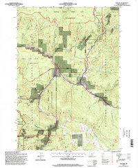
1995 Map of Granite
USGS Topo · Published 1998About this map
Gold mining heritage defines the landscape surrounding Granite and the settlement of Porterville in the late twentieth century. This survey documents a high concentration of lode and placer operations situated within the Wallowa-Whitman National Forest and Umatilla National Forest. Extensive tailings deposits are mapped along Granite Creek and Clear Creek, signaling decades of hydraulic and dredge mining activity. Historically significant sites, such as the Fremont Powerhouse and the Granite Cem, provide evidence of the area's industrial and social longevity.
Find a feature on this map
80 named features on this map. Tap any name to fly to it.
Don’t see what you’re looking for? This feature index may not catch every label — zoom into the map to look around manually.
Map Details
Editions of this 1995 Granite Map
This is the sole edition of this map. No revisions or reprints were ever made.
Other maps of this area

1901 · Sumpter
USGS Topo · 1:125,000

1951 · Bates
USGS Topo · 1:62,500

1951 · Desolation Butte
USGS Topo · 1:62,500

1955 · Canyon City
USGS Topo · 1:250,000

1959 · Canyon City
USGS Topo · 1:250,000

1961 · Whitney
USGS Topo · 1:24,000

1972 · Trout Meadows
USGS Topo · 1:24,000

1972 · Mt. Ireland
USGS Topo · 1:24,000
1972 · Granite
USGS Topo · 1:24,000

1972 · Greenhorn
USGS Topo · 1:24,000