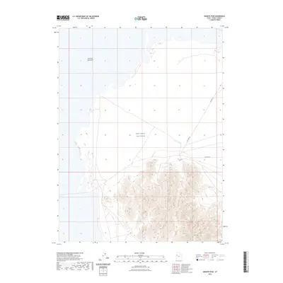
2023 Map of Granite Peak
USGS Topo · Published 2023About this map
Granite Peak dominates the southern landscape of this quadrant, rising sharply out of the surrounding flats in the eastern reaches of the Great Salt Lake Desert. This isolated topographic feature is situated within the West Desert Test Center, a secure facility that limits modern access to this part of the Utah salt flats. The presence of the testing center dictates the minimalist infrastructure shown on the map, with a small network of named service routes including Falconer Rd, Stark Rd, and Goodyear Rd skirting the northern and eastern base of the peak. The vast, low-lying alkaline expanse to the north and west highlights the stark isolation of the mountain, which served as a critical navigational landmark across the arid basin for early travelers and modern military operations alike.
Find a feature on this map
6 named features on this map. Tap any name to fly to it.
Don’t see what you’re looking for? This feature index may not catch every label — zoom into the map to look around manually.
Map Details
Editions of this 2023 Granite Peak Map
This is the sole edition of this map. No revisions or reprints were ever made.
Other maps of this area

1953 · Tooele
USGS Topo · 1:250,000

1954 · Wig Mtn SW
USGS Topo · 1:24,000

1954 · Granite Peak
USGS Topo · 1:24,000

1954 · Dugway Proving Ground SW
USGS Topo · 1:24,000

1954 · Wildcat Mtn SE
USGS Topo · 1:24,000

1954 · Dugway Proving Ground NW
USGS Topo · 1:24,000

1954 · Granite Peak SE
USGS Topo · 1:24,000

1955 · Tooele
USGS Topo · 1:250,000

1973 · Wildcat Mountain SW
USGS Topo · 1:24,000

1973 · Granite Peak NW
USGS Topo · 1:24,000