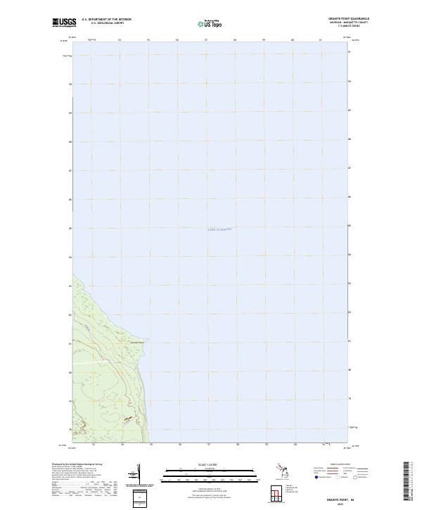
2023 Map of Granite Point
USGS Topo · Published 2023About this map
Granite Point juts into the cold waters of Lake Superior in this recent survey of the Marquette County coastline. The terrain is defined by its interface with the Great Lakes, showing the immediate transition from the water's edge to the inland woods of northern Michigan. Grounded in the Public Land Survey System, the map details the boundaries of t51n r26w, t50n r27w, and t50n r26w, providing a precise record of land division in this maritime environment. Transportation through the coastal forest is primary via Co Rd KB, which winds through the southern sections of the quadrangle. This documentation reflects the modern state of the shoreline before further natural or man-made changes occur, serving as a reliable baseline for coastal studies and local land management.
Find a feature on this map
6 named features on this map. Tap any name to fly to it.
Don’t see what you’re looking for? This feature index may not catch every label — zoom into the map to look around manually.
Map Details
Editions of this 2023 Granite Point Map
This is the sole edition of this map. No revisions or reprints were ever made.
Other maps of this area

1907 · Marquette
USGS Topo · 1:62,500

1953 · Marquette NW
USGS Topo · 1:24,000

1954 · Negaunee
USGS Topo · 1:62,500

1954 · Big Bay
USGS Topo · 1:62,500

1954 · Marquette
USGS Topo · 1:62,500

1958 · Marquette
USGS Topo · 1:250,000

1960 · Marquette
USGS Topo · 1:250,000

1961 · Marquette
USGS Topo · 1:250,000

1968 · Marquette
USGS Topo · 1:250,000
1985 · Granite Point
USGS Topo · 1:24,000