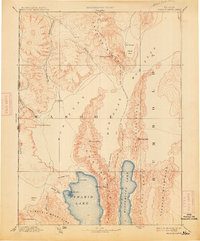
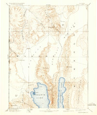
1894 Map of Granite Range
USGS Topo · Published 1923About this map
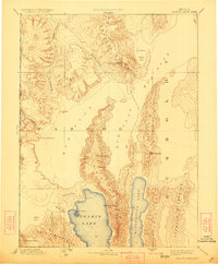
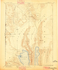
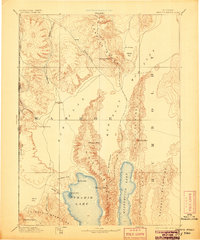
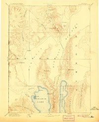
Pyramid Lake and Winnemucca Lake dominate the southern reach of this late nineteenth-century reconnaissance, a landscape defined by terminal lakes and internal drainage. To the north, the Smoke Creek Desert gives way to the high elevation of the Granite Range, where Granite Peak and several Springs provided critical water sources in an otherwise arid environment. This period of Western survey captured early industry such as the Salt Works located on the Mud Flat, a reminder of the region's mineral extraction roots during the transition from territory to statehood. The map also delineates the Nevada California boundary line and prominent terrain markers like Pah-rum Peak and The Needles, which served as essential waypoints for early travelers navigating the corridors between the Virginia Mountains and the Selenite Range.
Find a feature on this map
30 named features on this map. Tap any name to fly to it.
Don’t see what you’re looking for? This feature index may not catch every label — zoom into the map to look around manually.
Map Details
Editions of this 1894 Granite Range Map
7 editions found

Other maps of this area

1886 · Alturas
USGS Topo · 1:250,000

1886 · Honey Lake
USGS Topo · 1:250,000

1886 · Disaster
USGS Topo · 1:250,000

1886 · Granite Range
USGS Topo · 1:250,000

1889 · Long Valley
USGS Topo · 1:250,000

1890 · Wadsworth
USGS Topo · 1:125,000

1890 · Sierraville
USGS Topo · 1:125,000

1891 · Honey Lake
USGS Topo · 1:250,000

1891 · Reno
USGS Topo · 1:125,000

1892 · Wadsworth
USGS Topo · 1:125,000