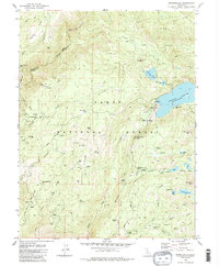
1982 Map of Graniteville
USGS Topo · Published 1986About this map
Graniteville stands as a focal point in this high-elevation landscape of the Tahoe National Forest, situated near a complex network of gold-era mining claims and hydraulic works. The map illustrates a transition from active extraction to historical memory, marking several locations as sites, including the Gaston (Site), Marsh Mill (Site), and the Old Condon Mill (Site). Water management for mining and later uses is evident through the massive Bowman Lake and the engineered Clear Creek Tunnel, which diverted flows through the ridges. The terrain is defined by steep ridges like Celina Ridge and Gaston Ridge, separating deep canyons and high meadows. For local historians, the inclusion of the Cem near Graniteville and numerous family-named mines such as the Spotswood Mine, Birchville Mine, and Nixon Mine provides a detailed look at the 19th-century industrial footprint remaining in the late 20th century.
Find a feature on this map
83 named features on this map. Tap any name to fly to it.
Don’t see what you’re looking for? This feature index may not catch every label — zoom into the map to look around manually.
Map Details
Editions of this 1982 Graniteville Map
4 editions found
Other maps of this area

1891 · Downieville
USGS Topo · 1:125,000

1891 · Colfax
USGS Topo · 1:125,000

1892 · Colfax
USGS Topo · 1:125,000

1893 · Downieville
USGS Topo · 1:125,000

1894 · Colfax
USGS Topo · 1:125,000

1895 · Downieville
USGS Topo · 1:125,000

1896 · Downieville
USGS Topo · 1:125,000

1897 · Downieville
USGS Topo · 1:125,000

1898 · Colfax
USGS Topo · 1:125,000

1900 · Colfax
USGS Topo · 1:125,000