
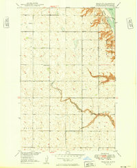
1949 Map of Grano SW
USGS Topo · Published 1949About this map
Upper Souris National Wildlife Refuge dominates the northeastern corner of this Renville County landscape, where the waters of Lake Darling are contained by a prominent spillway. The map captures a transition in the late 1940s, documenting a prairie environment structured by the township boundaries of Ivanhoe, Callahan, and White Ash. The winding course of Mackobee Coulee carves through the central terrain, providing a natural drainage system for the surrounding agricultural sections. Small community anchors are clearly marked, including Gethsemane Ch and rural education sites like School No 1 and School No 2. These labels reflect the dispersed settlement pattern characteristic of North Dakota's river basin development during this era, before many such rural schools and churches were consolidated or removed from the landscape.
Find a feature on this map
9 named features on this map. Tap any name to fly to it.
Don’t see what you’re looking for? This feature index may not catch every label — zoom into the map to look around manually.
Map Details
Editions of this 1949 Grano SW Map
2 editions found
Other maps of this area

1947 · Tolley
USGS Topo · 1:62,500

1948 · Tolley
USGS Topo · 1:24,000

1949 · Tolley SE
USGS Topo · 1:24,000

1949 · Hartland
USGS Topo · 1:24,000

1949 · Carpio NE
USGS Topo · 1:24,000

1949 · Carpio
USGS Topo · 1:24,000

1949 · Greene
USGS Topo · 1:24,000

1949 · Grano
USGS Topo · 1:24,000

1949 · Grano NE
USGS Topo · 1:24,000

1950 · Tolley
USGS Topo · 1:62,500