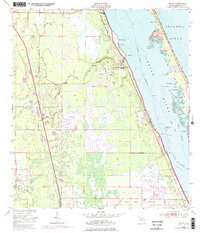
1949 Map of Grant
USGS Topo · Published 1976About this map
The Valkaria Missile Tracking Annex and adjacent Valkaria Airfield anchor this coastal landscape during a period of significant military and aerospace expansion. Situated between the Indian River and the extensive wetlands to the west, these facilities represent the mid-century transformation of Brevard County. The Florida East Coast railway runs parallel to the shore, connecting the riverside settlements of Malabar, Valkaria, and Grant.
Find a feature on this map
38 named features on this map. Tap any name to fly to it.
Don’t see what you’re looking for? This feature index may not catch every label — zoom into the map to look around manually.
Map Details
Editions of this 1949 Grant Map
4 editions found
Other maps of this area

1949 · Melbourne West
USGS Topo · 1:24,000

1949 · Fellsmere
USGS Topo · 1:24,000

1949 · Melbourne East
USGS Topo · 1:24,000

1949 · Sebastian NW
USGS Topo · 1:24,000

1949 · Sebastian
USGS Topo · 1:24,000

1949 · Grant
USGS Topo · 1:24,000

1951 · Sebastian NW
USGS Topo · 1:24,000

1951 · Melbourne East
USGS Topo · 1:24,000

1951 · Fellsmere
USGS Topo · 1:24,000

1951 · Melbourne West
USGS Topo · 1:24,000