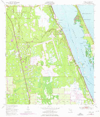
1949 Map of Grant
USGS Topo · Published 1976About this map
Valkaria Missile Tracking Annex and the Valkaria Airfield anchor the landscape of south Brevard County, documenting a mid-century period of rapid military and aerospace expansion. Situated along the Indian River, this coastal region shows a clear transition from the established rail-side settlements of Malabar, Valkaria, and Grant to the emerging infrastructure of the Cold War era. The Florida East Coast railway runs parallel to the shore, passing through historic districts like Fleming Grant and near local landmarks including a Cem and Shell Pit Pt. Coastal features such as Grant Farm Island and the intricate channels of Mullet Creek and Snug Harbor illustrate the area's maritime reliance, while inland, the network of drainage through Goat Creek and Trout Creek highlights the engineering required to develop these Florida wetlands during the late 1940s and through subsequent 1970 revisions.
Find a feature on this map
38 named features on this map. Tap any name to fly to it.
Don’t see what you’re looking for? This feature index may not catch every label — zoom into the map to look around manually.
Map Details
Editions of this 1949 Grant Map
4 editions found
Other maps of this area

1949 · Melbourne West
USGS Topo · 1:24,000

1949 · Fellsmere
USGS Topo · 1:24,000

1949 · Melbourne East
USGS Topo · 1:24,000

1949 · Sebastian NW
USGS Topo · 1:24,000

1949 · Sebastian
USGS Topo · 1:24,000

1949 · Grant
USGS Topo · 1:24,000

1951 · Sebastian NW
USGS Topo · 1:24,000

1951 · Melbourne East
USGS Topo · 1:24,000

1951 · Fellsmere
USGS Topo · 1:24,000

1951 · Melbourne West
USGS Topo · 1:24,000