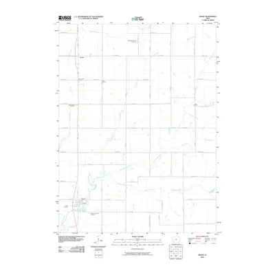
2010 Map of Grant
USGS Topo · Published 2010About this map
The West Nodaway River carves a winding path through this agricultural landscape, anchoring the village of Grant in the southwest and shaping the local drainage network. The area’s rural heritage is meticulously documented through a high density of burial grounds, providing a significant resource for genealogical research. These sites, including the Newtons Grove Cemetery, Weirich Cemetery, and Douglas Township Cemetery, are scattered across the section lines, often associated with early settlement clusters like Lyman.
Find a feature on this map
45 named features on this map. Tap any name to fly to it.
Don’t see what you’re looking for? This feature index may not catch every label — zoom into the map to look around manually.
Map Details
Editions of this 2010 Grant Map
This is the sole edition of this map. No revisions or reprints were ever made.
Other maps of this area

1954 · Omaha
USGS Topo · 1:250,000

1957 · Omaha
USGS Topo · 1:250,000

1958 · Omaha
USGS Topo · 1:250,000

1971 · Anita SW
USGS Topo · 1:24,000

1971 · Lewis
USGS Topo · 1:24,000

1971 · Massena
USGS Topo · 1:24,000

1978 · Wallin
USGS Topo · 1:24,000

1978 · Griswold NE
USGS Topo · 1:24,000

1980 · Grant
USGS Topo · 1:24,000
1980 · Carbon
USGS Topo · 1:24,000