
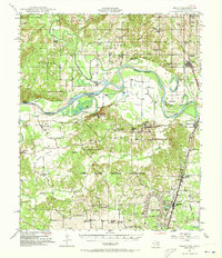
1948 Map of Grant
USGS Topo · Published 1963About this map
Camp Maxey Military Reservation dominates the landscape south of the Red River, reflecting the significant military presence in Lamar County during the mid-20th century. The intricate meanders of the river define the border between Oklahoma and Texas, creating distinctive features like Pitts Bend and Allen Island. The map records a dense network of rural infrastructure, including numerous family-named schools and churches such as Hills Chapel School and Cold Springs Church, which served the dispersed farming communities of the era.
Find a feature on this map
71 named features on this map. Tap any name to fly to it.
Don’t see what you’re looking for? This feature index may not catch every label — zoom into the map to look around manually.
Map Details
Editions of this 1948 Grant Map
2 editions found
Other maps of this area

1901 · Antlers
USGS Topo · 1:125,000

1901 · Alikchi
USGS Topo · 1:125,000

1903 · Paris
USGS Topo · 1:125,000

1912 · Antlers
USGS Topo · 1:125,000

1925 · Antlers
USGS Topo · 1:125,000

1947 · Honey Grove
USGS Topo · 1:62,500

1948 · Paris
USGS Topo · 1:62,500

1948 · Direct
USGS Topo · 1:62,500

1949 · Direct
USGS Topo · 1:62,500

1949 · Honey Grove
USGS Topo · 1:62,500