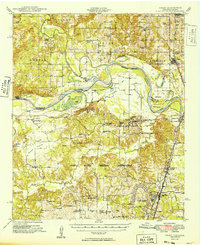
1949 Map of Grant
USGS Topo · Published 1949About this map
The Red River creates a meandering border between Oklahoma and Texas, defining a landscape of oxbow lakes and fertile bends like Pitts Bend and Allen Island. North of the river, the landscape is dotted with early rural institutions such as the Goodland School and Antioch Church. This era marks a significant military presence in the region, with the expansive Camp Maxey Military Reservation occupying a large portion of the Texas side.
Find a feature on this map
70 named features on this map. Tap any name to fly to it.
Don’t see what you’re looking for? This feature index may not catch every label — zoom into the map to look around manually.
Map Details
Editions of this 1949 Grant Map
2 editions found

Other maps of this area

1901 · Antlers
USGS Topo · 1:125,000

1901 · Alikchi
USGS Topo · 1:125,000

1903 · Paris
USGS Topo · 1:125,000

1912 · Antlers
USGS Topo · 1:125,000

1925 · Antlers
USGS Topo · 1:125,000

1947 · Honey Grove
USGS Topo · 1:62,500

1948 · Grant
USGS Topo · 1:62,500

1948 · Paris
USGS Topo · 1:62,500

1948 · Direct
USGS Topo · 1:62,500

1949 · Direct
USGS Topo · 1:62,500