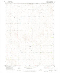
1973 Map of Grant NE
USGS Topo · Published 1977About this map
Stinking Water Creek winds through the southwestern portion of this Perkins County landscape, which was documented by the Geological Survey during the early 1970s. This region is characterized by an intricate network of intermittent drainage features and agricultural infrastructure, reflecting the high plains environment of southwest Nebraska. The presence of the Reiger Landing Strip in the central portion of the sheet highlights the importance of private aviation for local transportation and land management in this rural setting. Further north, the dry bed of Roscoe Draw carves through the terrain, while a long-distance Pipeline cuts across the northern townships. Numerous labels for Wells are scattered throughout the sections, underscoring the vital role of groundwater management for sustaining the area's agricultural operations and rural homesteads.
Find a feature on this map
5 named features on this map. Tap any name to fly to it.
Don’t see what you’re looking for? This feature index may not catch every label — zoom into the map to look around manually.
Map Details
Editions of this 1973 Grant NE Map
This is the sole edition of this map. No revisions or reprints were ever made.
Other maps of this area

1897 · Ogallala
USGS Topo · 1:125,000

1898 · Paxton
USGS Topo · 1:125,000

1900 · Ogallala
USGS Topo · 1:125,000

1901 · Paxton
USGS Topo · 1:125,000

1954 · McCook
USGS Topo · 1:250,000

1954 · North Platte
USGS Topo · 1:250,000

1956 · North Platte
USGS Topo · 1:250,000

1957 · North Platte
USGS Topo · 1:250,000

1957 · McCook
USGS Topo · 1:250,000

1958 · McCook
USGS Topo · 1:250,000