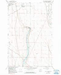
1956 Map of Grant Orchards
USGS Topo · Published 1991About this map
Grant Orchards (Soap Lake Sta) and the neighboring Lakeview Park define this mid-century agricultural and transit corridor in Grant County. The landscape is characterized by its hydrological reliance on Rocky Ford Creek and Crab Creek, which sustain the irrigation and industrial needs of the region. The presence of a dedicated Fish Hatchery and several groundwater wells indicates the careful management of water resources in this arid environment. Transportation and commerce are anchored by the Great Northern railroad, which cuts through the northern sections of the map, and the Ephrata Municipal Airport at the western edge. This 1950s data, field checked just after the war, shows the area as it transitioned into a more modern logistics and aviation hub while maintaining its orchard-based roots and early industrial sites like the local Gravel Pits.
Find a feature on this map
12 named features on this map. Tap any name to fly to it.
Don’t see what you’re looking for? This feature index may not catch every label — zoom into the map to look around manually.
Map Details
Editions of this 1956 Grant Orchards Map
3 editions found
Other maps of this area

1910 · Winchester
USGS Topo · 1:62,500

1912 · Moses Lake
USGS Topo · 1:62,500

1953 · Ritzville
USGS Topo · 1:250,000

1956 · Ephrata
USGS Topo · 1:62,500

1956 · Stratford
USGS Topo · 1:24,000

1956 · Ephrata
USGS Topo · 1:24,000

1956 · Grant Orchards
USGS Topo · 1:24,000

1956 · Moses Lake North
USGS Topo · 1:24,000

1956 · Gloyd
USGS Topo · 1:24,000

1956 · Winchester NE
USGS Topo · 1:24,000