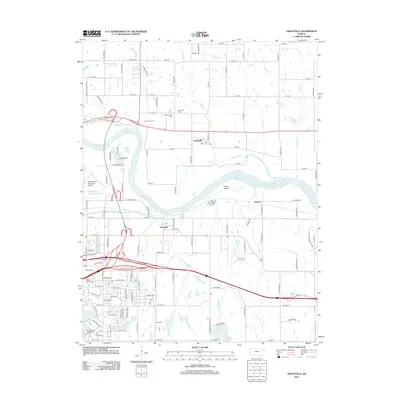
2012 Map of Grantville
USGS Topo · Published 2012About this map
Grantville and the surrounding river bottomlands define the landscape where Muddy Cr meets the Kansas River. This area northeast of Topeka shows a mix of historical settlement and modern infrastructure, including the Philip Billard Municipal Airport and the massive East Topeka Interchange. For local historians and genealogists, the map preserves the locations of three distinct burial grounds: Grantville Cem, Old Grantville Cem, and Bethel Cem. North of the river, the Rees Fruit Farm stands near the intersection of several established rural roads like NE Croco Rd. The southern portion of the sheet transitions into suburban development near Tecumseh, anchored by recreational features such as Lake Shawnee and Lake Jivaro. A complex network of drainage is visible, featuring the Old Channel Shunganunga Creek and the meandering path of Whetstone Cr.
Find a feature on this map
113 named features on this map. Tap any name to fly to it.
Don’t see what you’re looking for? This feature index may not catch every label — zoom into the map to look around manually.
Map Details
Editions of this 2012 Grantville Map
This is the sole edition of this map. No revisions or reprints were ever made.
Other maps of this area

1885 · Lawrence
USGS Topo · 1:125,000

1886 · Oskaloosa
USGS Topo · 1:125,000

1888 · Oskaloosa
USGS Topo · 1:125,000

1889 · Burlingame
USGS Topo · 1:125,000

1889 · Topeka
USGS Topo · 1:125,000

1889 · Lawrence
USGS Topo · 1:125,000

1894 · Burlingame
USGS Topo · 1:125,000

1894 · Oskaloosa
USGS Topo · 1:125,000

1894 · Topeka
USGS Topo · 1:125,000

1947 · Lawrence
USGS Topo · 1:250,000